First Name:
DayaniLast Name:
DavillaMentor:
Dr. Chetan TiwariAbstract:
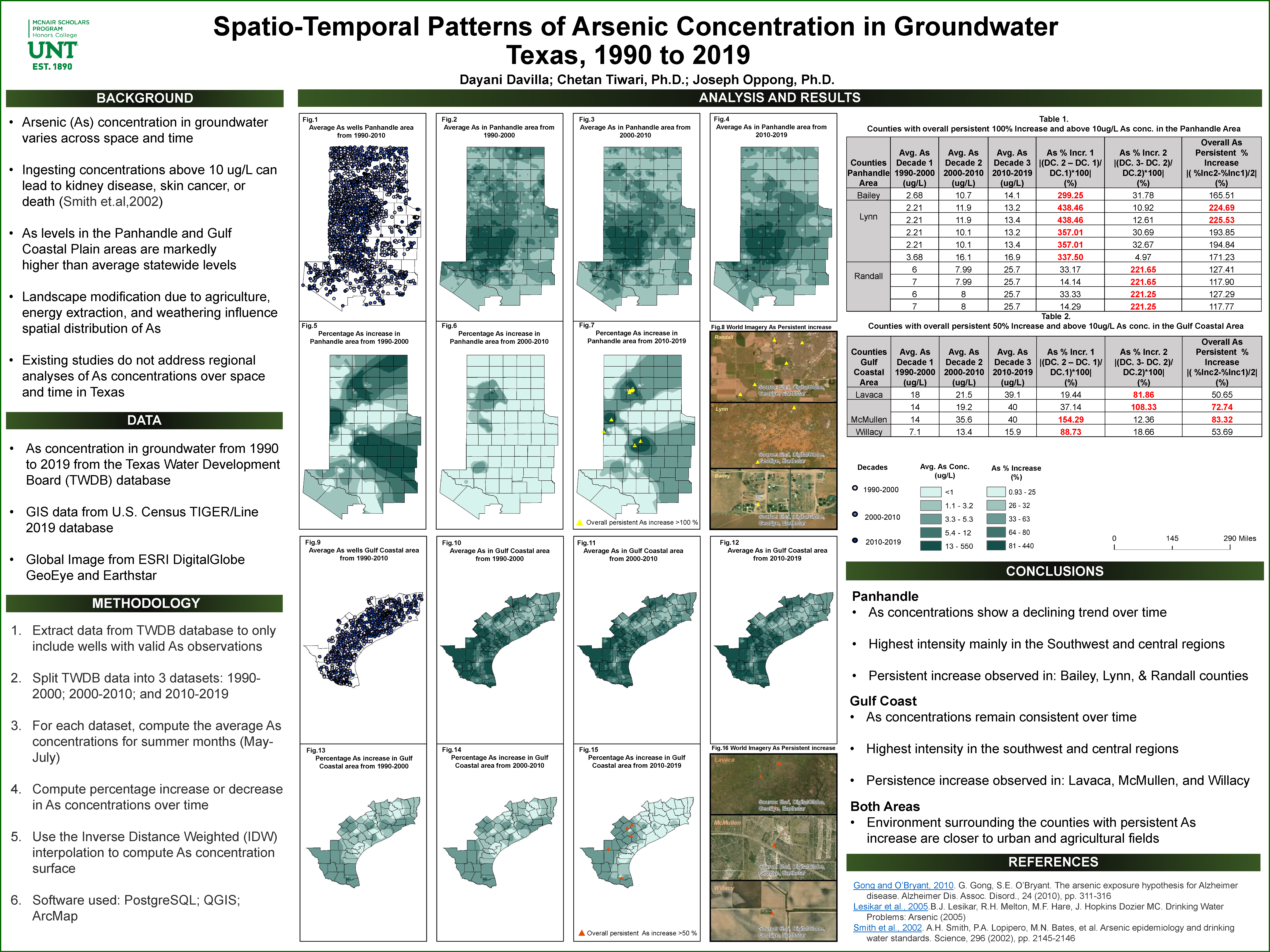
Arsenic concentration in groundwater varies across space and time and may increase or decrease with geological processes and/or human activity. There is a need to identify areas with historically elevated values of Ar in groundwater as well as those with persistent increase. Developing maps of existing and emerging risk of exposure will help guide health care intervention efforts for diseases that are commonly associated with Ar. The first map identifies those areas that are consistently in the top one-third of Ar concentration between 1990 to 2019. The second map identifies those areas that show persistent increases in Ar concentrations over 5-year increments for the same time period. For each 5-year increment, a Kriging model was developed to estimate Texas-wide Ar concentrations in groundwater using well data from the Texas Water Development Board’s groundwater quality database. Areas of persistent increase were computed by comparing estimates over successive time increments. The results show several areas of concern especially in the panhandle and gulf coast regions, where Ar concentrations exceed the 10 ug/L levels that studies show may contribute to an elevated risk of several diseases including kidney disease, skin cancer or even death.
Poster:


